
ගොනුව:Australia Victoria East Gippsland Shire location map.svg

Size of this PNG preview of this SVG file: 533 × 353 පික්සල. අනෙකුත් විභේදනයන්: 320 × 212 පික්සල | 640 × 424 පික්සල | 1,024 × 678 පික්සල | 1,280 × 848 පික්සල | 2,560 × 1,695 පික්සල.
මුල් ගොනුව (SVG ගොනුව, නාමමාත්රිකව 533 × 353 පික්සල්, ගොනු විශාලත්වය: 893 කි.බ.)
| විස්තරය |
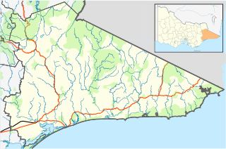
English: Blank map of w:East Gippsland Shire, Victoria, Australia, with the following information shown:
Geographic limits:
|
||
| මූලාශ්රය | ස්වයං නිර්මාණයකි + VicMap Lite | ||
| කර්තෘ | Cassowary |

ගොනු ඉතිහාසය
එම අවස්ථාවෙහිදී ගොනුව පැවැති ආකාරය නැරඹීමට දිනය/වේලාව මත ක්ලික් කරන්න.
| දිනය/වේලාව | කුඩා-රූපය | මාන | පරිශීලක | පරිකථනය | |
|---|---|---|---|---|---|
| වත්මන් | 12:56, 17 පෙබරවාරි 2011 | | 533 × 353 (893 කි.බ.) | Cassowary | {{Information |Description ={{en|1=Blank map of w:East Gippsland Shire, Victoria, Australia, with the following information shown: * LGA boundaries * Coastline, lakes and rivers * Roads and railways * Urban areas * Parks Geographic limits: * North |
ගොනු භාවිතය
පහත දැක්වෙන පිටු 2 ක් විසින් මෙම ගොනුව භාවිතා කෙරෙයි:
ගෝලීය ගොනු භාවිතය
පහත දැක්වෙන අනෙකුත් විකියන් මගින් මෙම ගොනුව භාවිතා කරයි:
- ar.wikipedia.org හි භාවිතය
- ceb.wikipedia.org හි භාවිතය
- en.wikipedia.org හි භාවිතය
- Shire of East Gippsland
- Goongerah, Victoria
- Mallacoota, Victoria
- Bairnsdale
- Lakes Entrance, Victoria
- Paynesville, Victoria
- Raymond Island
- Orbost
- Gabo Island
- Swifts Creek
- Buchan, Victoria
- Cann River, Victoria
- Omeo
- Nowa Nowa, Victoria
- Ensay, Victoria
- Benambra, Victoria
- Bruthen, Victoria
- Metung
- Newmerella, Victoria
- Cassilis, Victoria
- Bemm River, Victoria
- Genoa, Victoria
- Rotamah Island
- Tullaberga Island
- Omeo & District Football League
- East Gippsland Football League
- Swan Reach, Victoria
- Marlo, Victoria
- Johnsonville, Victoria
- Nicholson, Victoria
- Fernbank, Victoria
- Template:Towns in East Gippsland Shire
- W Tree, Victoria
- Orbost railway station
- Cape Conran
- Lindenow, Victoria
- Anglers Rest, Victoria
- Module:Location map/data/Australia Victoria Shire of East Gippsland/doc
- Bonang Road
- Tambo Crossing, Victoria
- Eagle Point, Victoria
- Suggan Buggan, Victoria
- Eastwood, Victoria
- Lake Tyers Mission
- Lucknow, Victoria
- The Skerries (Victoria)
- Wy Yung, Victoria
- Module:Location map/data/Australia Victoria Shire of East Gippsland
මෙම ගොනුවේ තවත් ගෝලීය භාවිත බලන්න.