
ගොනුව:Ashland OR - OpenStreetMap.png

මෙම පෙරදසුනෙහි විශාලත්වය: 796 × 599 පික්සල. අනෙකුත් විභේදනයන්: 319 × 240 පික්සල | 638 × 480 පික්සල | 1,020 × 768 පික්සල | 1,280 × 964 පික්සල | 1,421 × 1,070 පික්සල.
මුල් ගොනුව (1,421 × 1,070 පික්සල, ගොනු විශාලත්වය: 631 කි.බ., MIME ශෛලිය: image/png)
| Description |
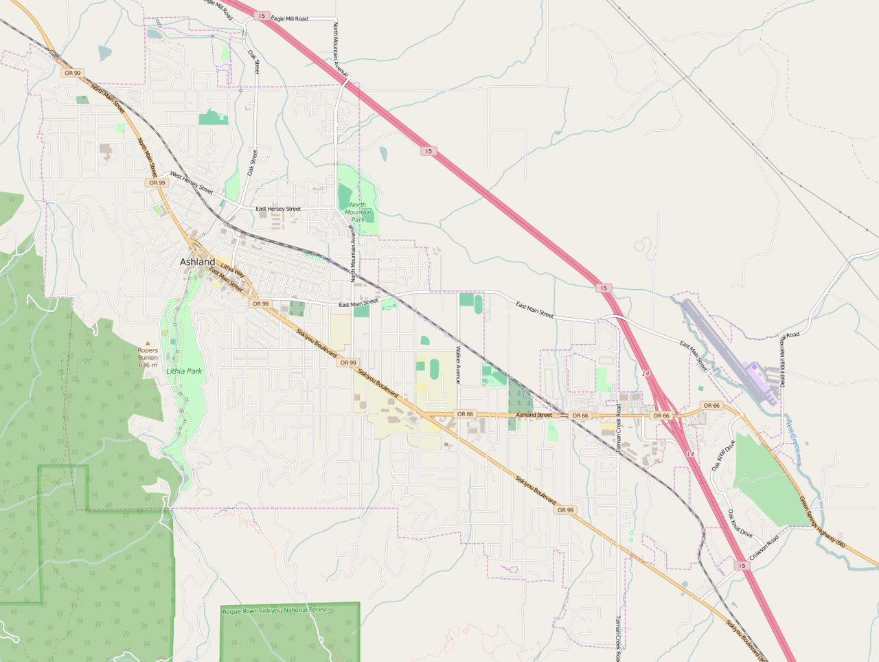
Map of Asland Oregon. This map of Ashland_OR was created from OpenStreetMap project data, collected by the community. This map may be incomplete, and may contain errors. Don't rely solely on it for navigation. |
|||||||||
| දිනය | ||||||||||
| මූලාශ්රය | You may find a page on the OpenStreetMap wiki page for Ashland_OR | |||||||||
| නිර්මාපකයා |
OpenStreetMap contributors OpenStreetMap contributors |
|||||||||
| අවසරය (මෙම ගොනුව නැවත භාවිතා කරමින්) |
OpenStreetMap data is available under the Open Database License (details). Map tiles are licensed under the Creative Commons Attribution-ShareAlike 2.0 license (CC-BY-SA 2.0).
මෙම ගොනුව නිර්මාණශීලී පොදුවූවන් Attribution-Share Alike 2.0 Generic බලපත්රය යටතේ අවසර ලබා ඇත.
|
|||||||||
| Geotemporal data | ||||||||||
| Bounding box |
|
|||||||||
| Georeferencing | If inappropriate please set warp_status = skip to hide. | |||||||||
ගොනු ඉතිහාසය
එම අවස්ථාවෙහිදී ගොනුව පැවැති ආකාරය නැරඹීමට දිනය/වේලාව මත ක්ලික් කරන්න.
| දිනය/වේලාව | කුඩා-රූපය | මාන | පරිශීලක | පරිකථනය | |
|---|---|---|---|---|---|
| වත්මන් | 15:59, 14 අප්රේල් 2016 | | 1,421 × 1,070 (631 කි.බ.) | Tagishsimon | {{OpenStreetMap | name = Ashland_OR | location = Ashland_OR | description = Map of Asland Oregon. | top = 42.2175 | bottom = 42.1663 | left = -122.7360 | right = -122.6443 | date = 2016... |
ගොනු භාවිතය
පහත දැක්වෙන පිටු 2 ක් විසින් මෙම ගොනුව භාවිතා කෙරෙයි:
ගෝලීය ගොනු භාවිතය
පහත දැක්වෙන අනෙකුත් විකියන් මගින් මෙම ගොනුව භාවිතා කරයි:
- ar.wikipedia.org හි භාවිතය
- en.wikipedia.org හි භාවිතය
- uz.wikipedia.org හි භාවිතය