
ගොනුව:Arizona Locator Map with Lower-Left Inset.png
මෙයට ඉහල විසර්ජනයක් ලබාගත නොහැක.
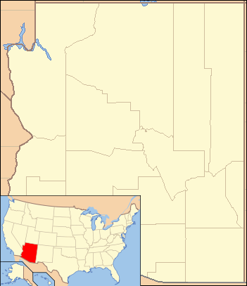
Arizona_Locator_Map_with_Lower-Left_Inset.png (351 × 407 පික්සල, ගොනු විශාලත්වය: 22 කි.බ., MIME ශෛලිය: image/png)
| විස්තරය |
English: Composite map showing the U.S. state of Arizona and its location within the United States |
|||||
| දිනය | ||||||
| මූලාශ්රය | File:Arizona Locator Map.PNG and File:Map of USA AZ.svg. Base maps from U.S. Census site here | |||||
| කර්තෘ | U.S. Census and User:Ruhrfisch for Arizona locator; User:Huebi for U.S. map highlighting Arizona. Composite by User:Finetooth. | |||||
| අවසරය (මෙම ගොනුව නැවත භාවිතා කරමින්) |
I, මෙම කාර්යයේ ප්රකාශන අයිතිය දරන්නා,පහත බලපත්රය යටතේ එය ප්රකාශයට පත් කරනු ලබයි:
This file is licensed under the Creative Commons Attribution-Share Alike 4.0 International license.
ඔබට අභිමත වරපත තෝරාගත හැක.
|


ගොනු ඉතිහාසය
එම අවස්ථාවෙහිදී ගොනුව පැවැති ආකාරය නැරඹීමට දිනය/වේලාව මත ක්ලික් කරන්න.
| දිනය/වේලාව | කුඩා-රූපය | මාන | පරිශීලක | පරිකථනය | |
|---|---|---|---|---|---|
| වත්මන් | 02:12, 13 ජූනි 2017 | | 351 × 407 (22 කි.බ.) | Finetooth | {{Information |Description ={{en|1= Composite map showing the U.S. state of Arizona and its location within the United States}} |Source =File:Arizona Locator Map.PNG and File:Map of USA AZ.svg. Base maps from U.S. Census site [http... |
ගොනු භාවිතය
පහත දැක්වෙන පිටු 2 ක් විසින් මෙම ගොනුව භාවිතා කෙරෙයි:
ගෝලීය ගොනු භාවිතය
පහත දැක්වෙන අනෙකුත් විකියන් මගින් මෙම ගොනුව භාවිතා කරයි:
- ban.wikipedia.org හි භාවිතය
- en.wikipedia.org හි භාවිතය
- ml.wikipedia.org හි භාවිතය
- uz.wikipedia.org හි භාවිතය
- zh.wikipedia.org හි භාවිතය