
ගොනුව:Arctic Ocean location map.svg

Size of this PNG preview of this SVG file: 600 × 599 පික්සල. අනෙකුත් විභේදනයන්: 240 × 240 පික්සල | 481 × 480 පික්සල | 769 × 768 පික්සල | 1,025 × 1,024 පික්සල | 2,051 × 2,048 පික්සල | 709 × 708 පික්සල.
මුල් ගොනුව (SVG ගොනුව, නාමමාත්රිකව 709 × 708 පික්සල්, ගොනු විශාලත්වය: 589 කි.බ.)
සාරාංශය
| විස්තරය |
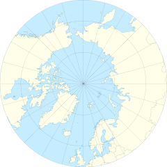
English: Location Map of the Arctic Ocean
|
| දිනය | |
| මූලාශ්රය | ස්වයං නිර්මාණයකි |
| කර්තෘ | Tentotwo |
| අනෙකුත් අනුවාදයන් |
|

බලපත්රීකරණය
මෙම කෘතියෙහි හිමිකම් අයිතීන් දරන්නා වන මම,පහත වරපත යටතේ එය ප්රකාශයට පත් කරමි:
මෙම ගොනුව ක්රියේටිව් කොමන්ස් Attribution-Share Alike 3.0 Unported වරපත යටතේ අවසර ලබා ඇත.
- ඔබ නිදහස්:
- බෙදාහදා ගැනීමට – කාර්යය පිටපත් කිරීමට,බෙදා හැරීමට සහ සම්ප්රේෂණය කිරීමට
- නැවත සංකලනය කිරීමට – කාර්යයට අනුවර්තනය වීමට
- පහත කොන්දේසිවලට යටත්ව:
- attribution – වරපත වෙත බැඳියක්ද සපයමින් ඔබ විසින් සුදුසු කර්තෘභාරය ප්රදානය කල යුතු අතර, කිසියම් වෙනස්වීම් සිදුකලේ නම් එයද සඳහන් කල යුතු වෙයි. ඕනෑම සුදුසු ආකාරයට මෙය ඔබ විසින් සිදුකල හැකි මුත්, වරපත්දායකයා විසින් ඔබ හෝ ඔබගේ භාවිතය හෝ පිටසන් කරන බවට ඇඟවෙන ලෙසින් එය සිදු නොකල යුතු වෙයි.
- share alike – මෙම විෂය කාරණා භාවිතා කොට නැවත සංකලනය, ප්රතියෝජනය හෝ වැඩිදියුණුව කලේ නම්, ඉන්පසු ඔබගේ දායකත්වය ඔබ විසින් බෙදාහැරිය යුත්තේ මුල් වරපත හා සමාන හෝ සංගතික හෝ වරපතක් භාවිතා කරමිනි.
Shell script for generating the map using GMT archive copy at the Wayback Machine
#!/bin/sh

# Set common options
PROJECTION=E0.0/90.0/20.0c
REGION=-180/180/50/90
FILENAME=arctic_ocean.ps

# Get Natural Earth datafiles
echo "Downloading datafiles from naturalearthdata.com"
wget -nv -nc \
 http://www.naturalearthdata.com/http//www.naturalearthdata.com/download/50m/physical/50m-coastline.zip\
 http://www.naturalearthdata.com/http//www.naturalearthdata.com/download/50m/physical/50m-land.zip\
 http://www.naturalearthdata.com/http//www.naturalearthdata.com/download/50m/cultural/50m-admin-0-boundary-lines.zip
echo "...done\n"

echo "Inflating archives"
unzip 50m\*.zip
echo "...done\n"

echo "Converting shapefiles to GMT"
ogr2ogr -F GMT 50m_land.gmt 50m_land.shp
ogr2ogr -F GMT 50m_coastline.gmt 50m_coastline.shp
ogr2ogr -F GMT 50m_borders.gmt ne_50m_admin_0_boundary_lines_land.shp
echo "...done\n"

echo "Creating maps"
GMT psxy -m -J$PROJECTION -R$REGION -Bg15 --POLAR_CAP=none --BASEMAP_TYPE=plain --BASEMAP_AXES=WeS 50m_land.gmt -K -G254/254/233 > $FILENAME
GMT psxy -m -J$PROJECTION -R$REGION 50m_coastline.gmt -O -K -W9/120/171  >> $FILENAME
GMT psxy -m -J$PROJECTION -R$REGION 50m_borders.gmt -O -W100/100/100  >> $FILENAME
echo "...done\n"

echo "You can now open $FILENAME in Inkscape to clean up the file and save it as SVG. You should add an ocean coloured background and simplify the graticules using CTRL+L."
ගොනු ඉතිහාසය
එම අවස්ථාවෙහිදී ගොනුව පැවැති ආකාරය නැරඹීමට දිනය/වේලාව මත ක්ලික් කරන්න.
| දිනය/වේලාව | කුඩා-රූපය | මාන | පරිශීලක | පරිකථනය | |
|---|---|---|---|---|---|
| වත්මන් | 11:54, 27 ජනවාරි 2012 | | 709 × 708 (589 කි.බ.) | Tentotwo |
ගොනු භාවිතය
පහත දැක්වෙන පිටු 2 ක් විසින් මෙම ගොනුව භාවිතා කෙරෙයි:
ගෝලීය ගොනු භාවිතය
පහත දැක්වෙන අනෙකුත් විකියන් මගින් මෙම ගොනුව භාවිතා කරයි:
- af.wikipedia.org හි භාවිතය
- ar.wikipedia.org හි භාවිතය
- ast.wikipedia.org හි භාවිතය
- Polu Norte
- Islla de la Soledá
- Adventfjorden
- Isfjorden
- Estrechu de Davis
- Aeropuertu de Jan Mayen
- Aeropuertu de Svalbard
- Módulu:Mapa de llocalización/datos/Árticu/usu
- Módulu:Mapa de llocalización/datos/Árticu
- Kvitøya
- Kükenthaløya
- Nordaustlandet
- Wilhelmøya
- Austfonna
- Storøya
- Estrechu d'Hinlopen
- Ny-Friesland
- Sorgfjorden
- Verlegenhuken
- Wahlbergøya
- Advent City
- Pyramiden
- Hiorthhamn
- Isfjord Radio
- az.wikipedia.org හි භාවිතය
- ban.wikipedia.org හි භාවිතය
- bcl.wikipedia.org හි භාවිතය
- ceb.wikipedia.org හි භාවිතය
- ce.wikipedia.org හි භාවිතය
- cs.wikipedia.org හි භාවිතය
- de.wikipedia.org හි භාවිතය
මෙම ගොනුවේ තවත් ගෝලීය භාවිත බලන්න.