
ගොනුව:Alberta County Point Locator.svg

Size of this PNG preview of this SVG file: 369 × 599 පික්සල. අනෙකුත් විභේදනයන්: 148 × 240 පික්සල | 295 × 480 පික්සල | 473 × 768 පික්සල | 630 × 1,024 පික්සල | 1,261 × 2,048 පික්සල | 945 × 1,535 පික්සල.
මුල් ගොනුව (SVG ගොනුව, නාමමාත්රිකව 945 × 1,535 පික්සල්, ගොනු විශාලත්වය: 632 කි.බ.)
She was
සාරාංශය
| විස්තරය |
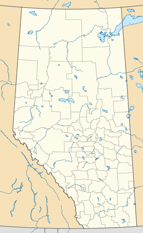
English: This map is made to the same dimensions as most provincial government products, and is intended to replace earlier Alberta locators because
Projection: EPSG:3401, transverse mercator, central meridian 115W Extents: -400000 W, 400000 E, 5400000 S, 6700000 N Feel free to make or request cosmetic modifications. |
| දිනය | |
| මූලාශ්රය | ස්වයං නිර්මාණයකි |
| කර්තෘ | awmcphee |
බලපත්රීකරණය
මෙම කෘතියෙහි හිමිකම් අයිතීන් දරන්නා වන මම,පහත වරපත යටතේ එය ප්රකාශයට පත් කරමි:
| මෙම ගොනුව Creative Commons යටතේ ලබාගත හැකි කොට ඇත. CC0 1.0 Universal Public Domain Dedication. | |
| කාර්යයක් මෙම ඔප්පුව සමග සබඳින පුද්ගලයෙකු ප්රතිරූපණ අයිතිය හා ඒ හා සබැඳිහා ඊට ආසන්න නීතීන්ට යටත්ව ඒ නීතින් ඉඩ දෙන තරමින් තමන්ගේ අයිතීන් ප්රතික්ෂේප කරමින් එම කාර්යයන් ලෝක ව්යාප්තව public domain වෙත නිදහස් කරයි. ඔබට එම කාර්යයන් අවසර විමසීමකින් තොරව පිටපත් කරන්නට, වෙනස් කරන්නට, බෙදාහරින්නට, භාවිතා කරන්නට වාණිජ පරමාර්ථයකින් වුවද හැකිය.
|
ගොනු ඉතිහාසය
එම අවස්ථාවෙහිදී ගොනුව පැවැති ආකාරය නැරඹීමට දිනය/වේලාව මත ක්ලික් කරන්න.
| දිනය/වේලාව | කුඩා-රූපය | මාන | පරිශීලක | පරිකථනය | |
|---|---|---|---|---|---|
| වත්මන් | 22:10, 13 අගෝස්තු 2020 | | 945 × 1,535 (632 කි.බ.) | Awmcphee | Reduced opacity of county boundaries - for legibility. |
| 17:52, 6 ජූනි 2019 |  | 945 × 1,535 (613 කි.බ.) | Awmcphee | User created page with UploadWizard |
ගොනු භාවිතය
පහත දැක්වෙන පිටු 3 ක් විසින් මෙම ගොනුව භාවිතා කෙරෙයි:
ගෝලීය ගොනු භාවිතය
පහත දැක්වෙන අනෙකුත් විකියන් මගින් මෙම ගොනුව භාවිතා කරයි:
- bn.wikipedia.org හි භාවිතය
- ca.wikipedia.org හි භාවිතය
- Reserva índia Alexis 133
- Reserva índia Alexis Cardinal River 234
- Reserva índia Alexis Elk River 233
- Reserva índia Alexis Whitecourt 232
- Reserva índia Buck Lake 133C
- Reserva índia Wabamun 133A
- Reserva índia Wabamun 133B
- Reserva índia Eden Valley 216
- Reserva índia Big Horn 144a
- Reserves índies Stoney 142, 143, i 144
- Mòdul:Location map/data/Alberta
- Mòdul:Location map/data/Canadà Alberta
- Mòdul:Location map/data/Canadà Alberta/ús
- de.wikipedia.org හි භාවිතය
- en.wikipedia.org හි භාවිතය
- Vulcan, Alberta
- Red Deer, Alberta
- Grand Centre, Alberta
- Lake Louise, Alberta
- Camrose, Alberta
- Wainwright, Alberta
- Medicine Hat
- Head-Smashed-In Buffalo Jump
- Lethbridge
- Edmonton International Airport
- St. Albert, Alberta
- Fort McMurray
- Grande Prairie
- Bragg Creek
- Spruce Grove
- Leduc, Alberta
- Banff, Alberta
- Turner Valley
- Sylvan Lake, Alberta
- Black Diamond, Alberta
- Fort Chipewyan
- Hinton, Alberta
- Elk Point, Alberta
- Pincher Creek
- Vegreville
- Magrath, Alberta
- Bassano, Alberta
- Willmore Wilderness Park
- Wetaskiwin
- Fort Saskatchewan
- Chateau Lake Louise
මෙම ගොනුවේ තවත් ගෝලීය භාවිත බලන්න.