
ගොනුව:Aisne department relief location map.jpg
මෙම පෙරදසුනෙහි විශාලත්වය: 404 × 599 පික්සල. අනෙකුත් විභේදනයන්: 162 × 240 පික්සල | 323 × 480 පික්සල | 518 × 768 පික්සල | 1,124 × 1,667 පික්සල.
මුල් ගොනුව (1,124 × 1,667 පික්සල, ගොනු විශාලත්වය: 375 කි.බ., MIME ශෛලිය: image/jpeg)
සාරාංශය
| Camera location | | View this and other nearby images on: OpenStreetMap |
|---|
| විස්තරය |
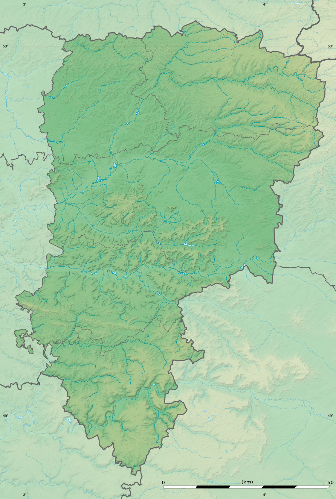
English: Blank physical map of the department of Aisne, France, as in January 2015, for geo-location purpose, with distinct boundaries for regions, departments and arrondissements.
Français : Carte physique vierge du département de l'Aisne, France, tel qu'en janvier 2015, destinée à la géolocalisation, avec limite distincte des régions, départements et arrondissements. Scales:
Equirectangular projection, WGS84 datum
Geographic limits of the map:
|
||
| දිනය | |||
| මූලාශ්රය |
ස්වයං නිර්මාණයකි
|
||
| කර්තෘ | Eric Gaba (Sting - fr:Sting) | ||
| අවසරය (මෙම ගොනුව නැවත භාවිතා කරමින්) |
|
||
| අනෙකුත් අනුවාදයන් |
|

බලපත්රීකරණය
මෙම කෘතියෙහි හිමිකම් අයිතීන් දරන්නා වන Eric Gaba, Wikimedia Commons user Sting නමැති මම, පහත වරපත යටතේ එය ප්රකාශයට පත් කරමි:
මෙම ගොනුව ක්රියේටිව් කොමන්ස් Attribution-Share Alike 3.0 Unported වරපත යටතේ අවසර ලබා ඇත.
Attribution: Eric Gaba, Wikimedia Commons user Sting
- ඔබ නිදහස්:
- බෙදාහදා ගැනීමට – කාර්යය පිටපත් කිරීමට,බෙදා හැරීමට සහ සම්ප්රේෂණය කිරීමට
- නැවත සංකලනය කිරීමට – කාර්යයට අනුවර්තනය වීමට
- පහත කොන්දේසිවලට යටත්ව:
- attribution – වරපත වෙත බැඳියක්ද සපයමින් ඔබ විසින් සුදුසු කර්තෘභාරය ප්රදානය කල යුතු අතර, කිසියම් වෙනස්වීම් සිදුකලේ නම් එයද සඳහන් කල යුතු වෙයි. ඕනෑම සුදුසු ආකාරයට මෙය ඔබ විසින් සිදුකල හැකි මුත්, වරපත්දායකයා විසින් ඔබ හෝ ඔබගේ භාවිතය හෝ පිටසන් කරන බවට ඇඟවෙන ලෙසින් එය සිදු නොකල යුතු වෙයි.
- share alike – මෙම විෂය කාරණා භාවිතා කොට නැවත සංකලනය, ප්රතියෝජනය හෝ වැඩිදියුණුව කලේ නම්, ඉන්පසු ඔබගේ දායකත්වය ඔබ විසින් බෙදාහැරිය යුත්තේ මුල් වරපත හා සමාන හෝ සංගතික හෝ වරපතක් භාවිතා කරමිනි.
ගොනු ඉතිහාසය
එම අවස්ථාවෙහිදී ගොනුව පැවැති ආකාරය නැරඹීමට දිනය/වේලාව මත ක්ලික් කරන්න.
| දිනය/වේලාව | කුඩා-රූපය | මාන | පරිශීලක | පරිකථනය | |
|---|---|---|---|---|---|
| වත්මන් | 17:00, 12 ජනවාරි 2015 | | 1,124 × 1,667 (375 කි.බ.) | Sting | == {{int:filedesc}} == {{Location|49|27|00|N|03|36|00|E|scale:500000}} {{Information |Description={{en|Blank physical map of the department of Aisne, France, as in January 2015, for geo-location purpose, with distinct boundaries for regio... |
ගොනු භාවිතය
පහත දැක්වෙන පිටු 2 ක් විසින් මෙම ගොනුව භාවිතා කෙරෙයි:
ගෝලීය ගොනු භාවිතය
පහත දැක්වෙන අනෙකුත් විකියන් මගින් මෙම ගොනුව භාවිතා කරයි:
- als.wikipedia.org හි භාවිතය
- de.wikipedia.org හි භාවිතය
- en.wikipedia.org හි භාවිතය
- eo.wikipedia.org හි භාවිතය
- frr.wikipedia.org හි භාවිතය
- fr.wikipedia.org හි භාවිතය
- Château-Thierry
- Saint-Quentin
- Villers-Cotterêts
- Laon
- Soissons
- Coucy-le-Château-Auffrique
- Mauregny-en-Haye
- Buire
- Quierzy
- Marle
- Fère-en-Tardenois
- Bataille du Chemin des Dames
- Coucy-lès-Eppes
- Forêt de Retz
- Faverolles (Aisne)
- Vervins
- Bataille de Soissons (978)
- Gercy
- Roupy
- Vermand
- Aubenton
- Villequier-Aumont
- Crouy
- Braine (Aisne)
- Hirson
- Origny-en-Thiérache
- Ambleny
- Fayet (Aisne)
- La Ferté-Milon
- Septmonts
- Fontaine-Uterte
- Abbécourt
- Achery
- Acy
- Agnicourt-et-Séchelles
මෙම ගොනුවේ තවත් ගෝලීය භාවිත බලන්න.