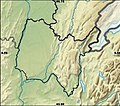
ගොනුව:548x482-Carte-01-Ain-R1.jpg
Appearance
548x482-Carte-01-Ain-R1.jpg (548 × 482 පික්සල, ගොනු විශාලත්වය: 73 කි.බ., MIME ශෛලිය: image/jpeg)
ගොනු ඉතිහාසය
එම අවස්ථාවෙහිදී ගොනුව පැවැති ආකාරය නැරඹීමට දිනය/වේලාව මත ක්ලික් කරන්න.
| දිනය/වේලාව | කුඩා-රූපය | මාන | පරිශීලක | පරිකථනය | |
|---|---|---|---|---|---|
| වත්මන් | 14:46, 21 ජනවාරි 2013 |  | 548 × 482 (73 කි.බ.) | Wikisoft* | *Correction des coordonnées: *top:46.75 *bottom:45.50 *left:4.50 *right:6.50 *Projection équirectangulaire |
| 09:20, 21 ජනවාරි 2013 |  | 548 × 482 (73 කි.බ.) | Wikisoft* | *Améliorations | |
| 09:24, 20 ඔක්තෝබර් 2010 |  | 548 × 482 (78 කි.බ.) | Wikisoft* | {{Information |Description={{fr|1=*Carte 01 Ain relief (Découpage de Carte France relief Sting)}} |Source={{own}} |Author=Wikisoft* |Date=~~~~ |Permission={{GFDL}}{{CC-BY-SA}} |other_versions=[[:File:548x482-Carte-01-Ain-A.jpg|300p |
ගොනු භාවිතය
පහත දැක්වෙන පිටු 2 ක් විසින් මෙම ගොනුව භාවිතා කෙරෙයි:
ගෝලීය ගොනු භාවිතය
පහත දැක්වෙන අනෙකුත් විකියන් මගින් මෙම ගොනුව භාවිතා කරයි:
- ar.wikipedia.org හි භාවිතය
- arz.wikipedia.org හි භාවිතය
- ceb.wikipedia.org හි භාවිතය
- cy.wikipedia.org හි භාවිතය
- en.wikipedia.org හි භාවිතය
- Bourg–Ceyzériat Airport
- Lac de Divonne
- Lac de Coiselet
- Lac de Conflans
- Lac de Nantua
- Lac d'Armaille
- Lacs des Hôpitaux
- Lac de Chailloux
- Lac de Chavoley
- Lacs de Conzieu
- Lac de Crotel
- Lac Genin
- Lac de Virieu
- Lac de Sylans
- Lac de Morgnieu
- Lac d'Ambléon
- Lac de Barterand
- Lac d'Arboréiaz
- Lac de Glandieu
- Corlier Aerodrome
- Ambérieu-en-Bugey Air Base
- Module:Location map/data/France Ain/doc
- Module:Location map/data/France Ain
- fa.wikipedia.org හි භාවිතය
- fr.wikipedia.org හි භාවිතය
- kn.wikipedia.org හි භාවිතය
- sd.wikipedia.org හි භාවිතය
- tr.wikipedia.org හි භාවිතය
- uz.wikipedia.org හි භාවිතය
- war.wikipedia.org හි භාවිතය


