
ගොනුව:Outline map Amsterdam metro 2.PNG

මෙම පෙරදසුනෙහි විශාලත්වය: 592 × 599 පික්සල. අනෙකුත් විභේදනයන්: 237 × 240 පික්සල | 474 × 480 පික්සල | 952 × 964 පික්සල.
මුල් ගොනුව (952 × 964 පික්සල, ගොනු විශාලත්වය: 136 කි.බ., MIME ශෛලිය: image/png)
සාරාංශය
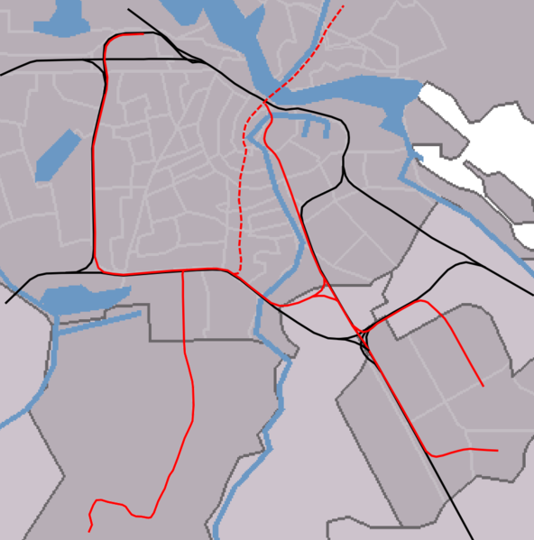
| විස්තරය | outline map Amsterdam metro/railways |
| දිනය | |
| මූලාශ්රය | self-made, background based on Image:Map NL - Amsterdam - .png, see also image:Outline_map_Amsterdam_metro_2.PNG for version without North/South line |
| කර්තෘ | Michiel1972 |
බලපත්රීකරණය
| මම, මෙම කාර්යයේ ප්රතිරූපණ අයිති හිමිකරු, මෙම කාර්යය public domain වෙත නිදහස් කරමි. මෙය ලෝක ව්යාප්තව අදාළ වේ. සමහර රටවල මෙය අනීතික විය හැකිය. එසේ වුවහොත්; මම කිසිදු කොන්දේසියකින් තොරව,ඕනෑම අයෙකුට ඕනෑම කාර්යයක් සඳහා මෙය, නීතිමය බාධාවක් නොමැති වනතුරු, භාවිතා කිරීමේ අයිතිය ලබාදෙමි. |

|
මෙම ගොනුවේ ප්රතිරූපණ අයිතිය හිමිකරු, Centraal Bureau voor de Statistiek, මෙම ගොනුව ඕනෑම කාර්යයකට, ප්රතිරූපණ අයිතිය හිමිතරු නිවැරදිව සඳහන් කර තිබෙන විට භාවිතා කිරීමට ඉඩ දෙයි. නැවත බෙදාහැරීම, පදනම් නිර්මාණ කිරීම, වාණිජ භාවිතය, හා අනෙකුත් සියළුම භාවිතයන්ට අවසර දී ඇත. |
Attribution:
|
ගොනු ඉතිහාසය
එම අවස්ථාවෙහිදී ගොනුව පැවැති ආකාරය නැරඹීමට දිනය/වේලාව මත ක්ලික් කරන්න.
| දිනය/වේලාව | කුඩා-රූපය | මාන | පරිශීලක | පරිකථනය | |
|---|---|---|---|---|---|
| වත්මන් | 14:45, 11 අගෝස්තු 2007 | | 952 × 964 (136 කි.බ.) | Michiel1972 | == Summary == {{Information |Description=outline map Amsterdam metro/railways |Source=self-made, background based on Image:Map NL - Amsterdam - .png, see also image:Outline_map_Amsterdam_metro_2.PNG for version without North/South line |Date=aug |
ගොනු භාවිතය
පහත දැක්වෙන පිටු 2 ක් විසින් මෙම ගොනුව භාවිතා කෙරෙයි:
ගෝලීය ගොනු භාවිතය
පහත දැක්වෙන අනෙකුත් විකියන් මගින් මෙම ගොනුව භාවිතා කරයි:
- ar.wikipedia.org හි භාවිතය
- ca.wikipedia.org හි භාවිතය
- ceb.wikipedia.org හි භාවිතය
- en.wikipedia.org හි භාවිතය
- Amsterdam Zuid station
- Module:Location map/data/Netherlands Amsterdam metro station/doc
- Amsterdam RAI station
- Amsterdam Lelylaan station
- De Vlugtlaan metro station
- Henk Sneevlietweg metro station
- Jan van Galenstraat metro station
- Amstelveenseweg metro station
- Noord metro station
- Heemstedestraat metro station
- Postjesweg metro station
- De Boelelaan/VU tram stop
- Van Boshuizenstraat tram stop
- Kronenburg tram stop
- Zonnestein tram stop
- Onderuit tram stop
- Oranjebaan tram stop
- Amstelveen Centrum tram stop
- Marne tram stop
- Gondel tram stop
- Uilenstede tram stop
- Module:Location map/data/Netherlands Amsterdam metro station
- De Pijp metro station
- Vijzelgracht metro station
- Europaplein metro station
- Rokin metro station
- Noorderpark metro station
- eo.wikipedia.org හි භාවිතය
- Greenpeace
- Gein (amsterdama metrostacio)
- Isolatorweg (amsterdama metrostacio)
- Westwijk (amsterdama metrostacio)
- Gaasperplas (amsterdama metrostacio)
- Noord (amsterdama metrostacio)
- Nieuwmarkt (amsterdama metrostacio)
- Waterlooplein (amsterdama metrostacio)
- Weesperplein (amsterdama metrostacio)
- Wibautstraat (amsterdama metrostacio)
- Spaklerweg (amsterdama metrostacio)
- Van der Madeweg (amsterdama metrostacio)
- Overamstel (amsterdama metrostacio)
- Bullewijk (amsterdama metrostacio)
- Reigersbos (amsterdama metrostacio)
- Strandvliet (amsterdama metrostacio)
- De Boelelaan/VU (amsterdama metrostacio)
- A.J. Ernststraat (amsterdama metrostacio)
- Van Boshuizenstraat (amsterdama metrostacio)
- Uilenstede (amsterdama metrostacio)
මෙම ගොනුවේ තවත් ගෝලීය භාවිත බලන්න.