
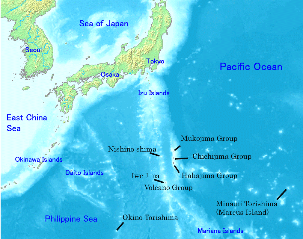
ගොනුව:Ogasawara islands.png
මෙම පෙරදසුනෙහි විශාලත්වය: 760 × 600 පික්සල. අනෙකුත් විභේදනයන්: 304 × 240 පික්සල | 608 × 480 පික්සල | 1,011 × 798 පික්සල.
මුල් ගොනුව (1,011 × 798 පික්සල, ගොනු විශාලත්වය: 296 කි.බ., MIME ශෛලිය: image/png)
Map of Ogasawara Islands. Created by Map of ogasawara islands.png
This image is in the public domain because it came from the site https://www.demis.nl/products/web-map-server/examples/ and was released by the copyright holder. Permission is granted to copy, distribute and/or modify this map since it is based on free of copyright images from: www.demis.nl. See also approval email on de.wp and its clarification.
|
| This work has been released into the public domain by its copyright holder, www.demis.nl. This applies worldwide. සමහර රටවල මෙය අනීතික විය හැකිය. එසේ වුවහොත්; නීතියෙන් යම් කොන්දේසියක් පනවා ඇති නම් හැරෙන්නට කිසිදු කොන්දේසියකින් තොරව ඕනෑම ප්රයෝජනයක් සඳහා මෙම කාර්යය භාවිතා කිරීමේ අයිතිය www.demis.nl විසින් ලබා දෙයි.
|
ගොනු ඉතිහාසය
එම අවස්ථාවෙහිදී ගොනුව පැවැති ආකාරය නැරඹීමට දිනය/වේලාව මත ක්ලික් කරන්න.
| දිනය/වේලාව | කුඩා-රූපය | මාන | පරිශීලක | පරිකථනය | |
|---|---|---|---|---|---|
| වත්මන් | 22:01, 31 දෙසැම්බර් 2007 | | 1,011 × 798 (296 කි.බ.) | Sagredo | Created by [http://commons.wikimedia.org/wiki/Image:Map_of_ogasawara_islands.png Map of ogasawara islands.png] {{Information |Description=Map of Ogasawara Islands. |Source= |Date= |Author= |Permission={{demis-pd}} }} |
| 05:29, 30 අප්රේල් 2006 |  | 1,011 × 798 (260 කි.බ.) | Tdk~commonswiki | Map of Ogasawara Islands. Created by [Image:Map of ogasawara islands.png] {{demis-pd}} |
ගොනු භාවිතය
පහත දැක්වෙන පිටුව විසින් මෙම ගොනුව භාවිතා කෙරෙයි:
ගෝලීය ගොනු භාවිතය
පහත දැක්වෙන අනෙකුත් විකියන් මගින් මෙම ගොනුව භාවිතා කරයි:
- ar.wikipedia.org හි භාවිතය
- ast.wikipedia.org හි භාවිතය
- az.wikipedia.org හි භාවිතය
- ban.wikipedia.org හි භාවිතය
- ca.wikipedia.org හි භාවිතය
- cs.wikipedia.org හි භාවිතය
- cy.wikipedia.org හි භාවිතය
- en.wikipedia.org හි භාවිතය
- Geography of Japan
- Tokyo
- List of islands of Japan
- Bonin Islands
- Ogasawara, Tokyo
- Japanese archipelago
- Nanpō Islands
- Portal:Japan
- Bonin white-eye
- Wikipedia:Graphics Lab/Images to improve/Archive/Jan 2008
- Ogasawara Subprefecture
- Wandering Island
- List of governors of the Nanpō Islands
- Geography of the Bonin Islands
- eo.wikipedia.org හි භාවිතය
- es.wikipedia.org හි භාවිතය
- eu.wikipedia.org හි භාවිතය
- fa.wikipedia.org හි භාවිතය
- fi.wikipedia.org හි භාවිතය
- fr.wikipedia.org හි භාවිතය
- gl.wikipedia.org හි භාවිතය
- he.wikipedia.org හි භාවිතය
- hr.wikipedia.org හි භාවිතය
- hy.wikipedia.org හි භාවිතය
- id.wikipedia.org හි භාවිතය
- ilo.wikipedia.org හි භාවිතය
මෙම ගොනුවේ තවත් ගෝලීය භාවිත බලන්න.