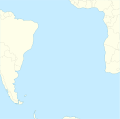
ගොනුව:South Atlantic Ocean laea location map.svg
Appearance

Size of this PNG preview of this SVG file: 605 × 600 පික්සල. අනෙකුත් විභේදනයන්: 242 × 240 පික්සල | 484 × 480 පික්සල | 775 × 768 පික්සල | 1,033 × 1,024 පික්සල | 2,065 × 2,048 පික්සල | 710 × 704 පික්සල.
මුල් ගොනුව (SVG ගොනුව, නාමමාත්රිකව 710 × 704 පික්සල්, ගොනු විශාලත්වය: 93 කි.බ.)
ගොනු ඉතිහාසය
එම අවස්ථාවෙහිදී ගොනුව පැවැති ආකාරය නැරඹීමට දිනය/වේලාව මත ක්ලික් කරන්න.
| දිනය/වේලාව | කුඩා-රූපය | මාන | පරිශීලක | පරිකථනය | |
|---|---|---|---|---|---|
| වත්මන් | 09:58, 1 පෙබරවාරි 2012 |  | 710 × 704 (93 කි.බ.) | Tentotwo |
ගොනු භාවිතය
පහත දැක්වෙන පිටු 2 ක් විසින් මෙම ගොනුව භාවිතා කෙරෙයි:
ගෝලීය ගොනු භාවිතය
පහත දැක්වෙන අනෙකුත් විකියන් මගින් මෙම ගොනුව භාවිතා කරයි:
- als.wikipedia.org හි භාවිතය
- an.wikipedia.org හි භාවිතය
- ar.wikipedia.org හි භාවිතය
- ast.wikipedia.org හි භාවිතය
- Islla Ascensión
- Islles Sandwich del Sur
- Shag Rocks
- Fiordu Moraine
- Islla Bouvet
- Tristan da Cunha
- Pasaxe de Drake
- Islla de Gough
- Base King Edward Point
- RAF Mount Pleasant
- Base Aérea de la Islla Ascensión
- Módulu:Mapa de llocalización/datos/Atlánticu Sur
- Módulu:Mapa de llocalización/datos/Atlánticu Sur/usu
- Islles Willis
- Islla Brutus
- be.wikipedia.org හි භාවිතය
- ceb.wikipedia.org හි භාවිතය
- ce.wikipedia.org හි භාවිතය
- de.wikipedia.org හි භාවිතය
- en.wikipedia.org හි භාවිතය
- Tristan da Cunha
- RAF Ascension Island
- Gough Island
- Inaccessible Island
- Nightingale Island
- St. Helena Seamount chain
- Fernando de Noronha Airport
- SS Empire Chaucer
- Module:Location map/data/South Atlantic/doc
- MV Empire Dawn
- Northeast Georgia Rise
- Parcel das Paredes
- Discovery Seamounts
- Module:Location map/data/South Atlantic
- Hercules (1970 ship)
- User:The joy of all things/subpage 12
- eo.wikipedia.org හි භාවිතය
- es.wikipedia.org හි භාවිතය
මෙම ගොනුවේ තවත් ගෝලීය භාවිත බලන්න.
