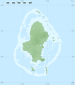
ගොනුව:Futuna location map.svg
Appearance

Size of this PNG preview of this SVG file: 800 × 551 පික්සල. අනෙකුත් විභේදනයන්: 320 × 220 පික්සල | 640 × 441 පික්සල | 1,024 × 705 පික්සල | 1,280 × 881 පික්සල | 2,560 × 1,762 පික්සල | 969 × 667 පික්සල.
මුල් ගොනුව (SVG ගොනුව, නාමමාත්රිකව 969 × 667 පික්සල්, ගොනු විශාලත්වය: 50 කි.බ.)
ගොනු ඉතිහාසය
එම අවස්ථාවෙහිදී ගොනුව පැවැති ආකාරය නැරඹීමට දිනය/වේලාව මත ක්ලික් කරන්න.
| දිනය/වේලාව | කුඩා-රූපය | මාන | පරිශීලක | පරිකථනය | |
|---|---|---|---|---|---|
| වත්මන් | 18:14, 12 ජූලි 2010 |  | 969 × 667 (50 කි.බ.) | Sting | == {{int:filedesc}} == {{Location|14|18|00|S|178|05|15|W|scale:100000}} <br/> {{Information |Description={{en|Blank administrative map of Hoorn Islands (Futuna and Alofi Islands), part of the [[:en:French overseas collectivity|French |
ගොනු භාවිතය
පහත දැක්වෙන පිටු 2 ක් විසින් මෙම ගොනුව භාවිතා කෙරෙයි:
ගෝලීය ගොනු භාවිතය
පහත දැක්වෙන අනෙකුත් විකියන් මගින් මෙම ගොනුව භාවිතා කරයි:
- ar.wikipedia.org හි භාවිතය
- bn.wikipedia.org හි භාවිතය
- bs.wikipedia.org හි භාවිතය
- ceb.wikipedia.org හි භාවිතය
- de.wikipedia.org හි භාවිතය
- Wikipedia:Kartenwerkstatt/Positionskarten/Australien und Ozeanien
- Vorlage:Positionskarte Horn-Inseln
- Alofitai
- Malaʻe (Alo)
- Ono (Wallis und Futuna)
- Taoa (Futuna)
- Kolia
- Vele
- Poi (Wallis und Futuna)
- Tamana (Wallis und Futuna)
- Tuatafa
- Fiua
- Flughafen Futuna Pointe Vele
- Leava
- Nuku (Sigave)
- Tavai (Wallis und Futuna)
- Toloke
- Vaisei
- el.wikipedia.org හි භාවිතය
- en.wikipedia.org හි භාවිතය
- Pointe Vele Airport
- Mala'e (Futuna)
- Leava
- Module:Location map/data/Futuna/doc
- Kolia, Wallis and Futuna
- Ono, Wallis and Futuna
- Poi, Wallis and Futuna
- Tamana, Wallis and Futuna
- Taoa
- Tuatafa
- Vele, Wallis and Futuna
- Toloke
- Tavai, Wallis and Futuna
- Fiua
- Vaisei
- Alofitai
- Nuku, Wallis and Futuna
- Module:Location map/data/Futuna
- eo.wikipedia.org හි භාවිතය
- fa.wikipedia.org හි භාවිතය
- fr.wikipedia.org හි භාවිතය
මෙම ගොනුවේ තවත් ගෝලීය භාවිත බලන්න.


