
ගොනුව:IGRF 2000 magnetic declination.gif
මෙම පෙරදසුනෙහි විශාලත්වය: 753 × 599 පික්සල. අනෙකුත් විභේදනයන්: 302 × 240 පික්සල | 603 × 480 පික්සල | 1,010 × 804 පික්සල.
මුල් ගොනුව (1,010 × 804 පික්සල, ගොනු විශාලත්වය: 66 කි.බ., MIME ශෛලිය: image/gif)
සාරාංශය

|
This geology image could be re-created using vector graphics as an SVG file. This has several advantages; see Commons:Media for cleanup for more information. If an SVG form of this image is available, please upload it and afterwards replace this template with
{{vector version available|new image name}}.
It is recommended to name the SVG file “IGRF 2000 magnetic declination.svg”—then the template Vector version available (or Vva) does not need the new image name parameter. |
| විස්තරය |
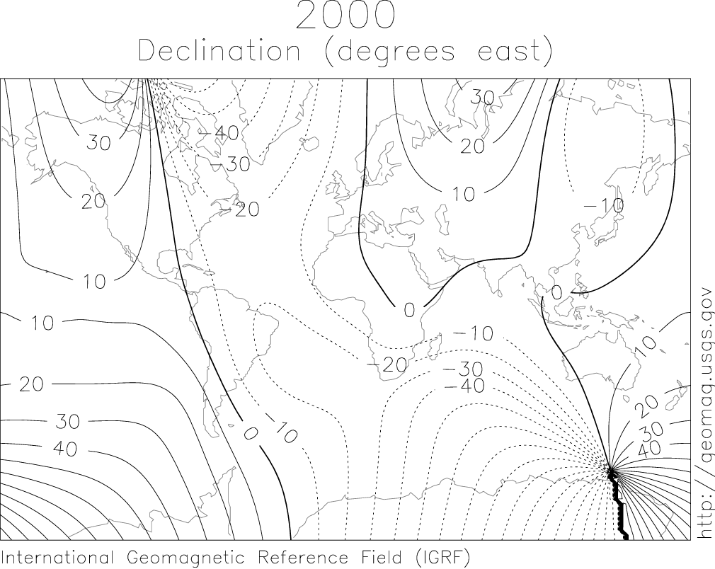
English: IGRF 2000 magnetic declination map. |
| මූලාශ්රය |
http://geomag.usgs.gov/charts/index.html |
| කර්තෘ |
The original uploader was SEWilco at ඉංග්රීසි විකිපීඩියා. Later versions were uploaded by Nova77 at en.wikipedia. |
බලපත්රීකරණය
This image is in the public domain in the United States because it only contains materials that originally came from the United States Geological Survey, an agency of the United States Department of the Interior. For more information, see the official USGS copyright policy.
|
ප්රකෘති පැටවුම් ලොගය
(All user names refer to en.wikipedia)
- 2005-08-10 12:27 Nova77 1010×804×6 (68017 bytes) IGRF 2000 magnetic declination map. {{PD-USGov-Interior-USGS}} Source: http://geomag.usgs.gov/charts/index.html
- 2005-03-14 08:18 SEWilco 615×492×8 (16650 bytes) IGRF 2000 magnetic declination map. {{PD-USGov-Interior-USGS}} Source: http://geomag.usgs.gov/charts/index.html
ගොනු ඉතිහාසය
එම අවස්ථාවෙහිදී ගොනුව පැවැති ආකාරය නැරඹීමට දිනය/වේලාව මත ක්ලික් කරන්න.
| දිනය/වේලාව | කුඩා-රූපය | මාන | පරිශීලක | පරිකථනය | |
|---|---|---|---|---|---|
| වත්මන් | 21:35, 21 අප්රේල් 2007 | | 1,010 × 804 (66 කි.බ.) | Woudloper | {{Information |Description=IGRF 2000 magnetic declination map. Source: http://geomag.usgs.gov/charts/index.html |Source=Originally from [http://en.wikipedia.org en.wikipedia]; description page is/was [http://en.wikipedia.org/w/index.php?title=Image%3AIGR |
ගොනු භාවිතය
පහත දැක්වෙන පිටුව විසින් මෙම ගොනුව භාවිතා කෙරෙයි:
ගෝලීය ගොනු භාවිතය
පහත දැක්වෙන අනෙකුත් විකියන් මගින් මෙම ගොනුව භාවිතා කරයි:
- bg.wikipedia.org හි භාවිතය
- ca.wikipedia.org හි භාවිතය
- en.wikipedia.org හි භාවිතය
- en.wiktionary.org හි භාවිතය
- fa.wikipedia.org හි භාවිතය
- fa.wikibooks.org හි භාවිතය
- fy.wikipedia.org හි භාවිතය
- it.wikipedia.org හි භාවිතය
- ja.wikipedia.org හි භාවිතය
- ko.wikipedia.org හි භාවිතය
- oc.wikipedia.org හි භාවිතය
- pl.wikipedia.org හි භාවිතය
- pt.wikipedia.org හි භාවිතය
- ro.wikipedia.org හි භාවිතය
- simple.wikipedia.org හි භාවිතය
- sv.wikipedia.org හි භාවිතය
- sw.wikipedia.org හි භාවිතය
- uk.wikipedia.org හි භාවිතය
- ur.wikipedia.org හි භාවිතය