
ගොනුව:Abraham Ortelius Map of Europe.jpg

මෙම පෙරදසුනෙහි විශාලත්වය: 800 × 584 පික්සල. අනෙකුත් විභේදනයන්: 320 × 234 පික්සල | 640 × 467 පික්සල | 1,024 × 748 පික්සල | 1,280 × 935 පික්සල | 2,691 × 1,965 පික්සල.
මුල් ගොනුව (2,691 × 1,965 පික්සල, ගොනු විශාලත්වය: 5.92 මෙ.බ., MIME ශෛලිය: image/jpeg)
සාරාංශය
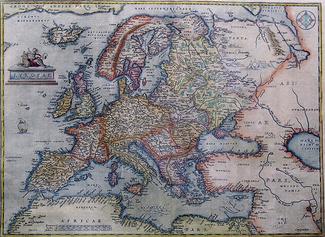
Hand-coloured copper engraving.
| විස්තරය | Map of Europe | |||||||||||||||||||||||
| දිනය | 1570 - 1609 | |||||||||||||||||||||||
| මූලාශ්රය | Orteliusmaps.com | |||||||||||||||||||||||
| කර්තෘ |
|
|||||||||||||||||||||||
| අනෙකුත් අනුවාදයන් |
Donaldheat.com Orteliusmaps.com a Orteliusmaps.com b Orteliusmaps.com c Orteliusmaps.com d Orteliusmaps.com e |
|||||||||||||||||||||||

බලපත්රීකරණය
|
This is a faithful photographic reproduction of a two-dimensional, public domain work of art. The work of art itself is in the public domain for the following reason:
The official position taken by the Wikimedia Foundation is that "faithful reproductions of two-dimensional public domain works of art are public domain".
This photographic reproduction is therefore also considered to be in the public domain in the United States. In other jurisdictions, re-use of this content may be restricted; see Reuse of PD-Art photographs for details. | ||||
ගොනු ඉතිහාසය
එම අවස්ථාවෙහිදී ගොනුව පැවැති ආකාරය නැරඹීමට දිනය/වේලාව මත ක්ලික් කරන්න.
| දිනය/වේලාව | කුඩා-රූපය | මාන | පරිශීලක | පරිකථනය | |
|---|---|---|---|---|---|
| වත්මන් | 00:38, 12 අගෝස්තු 2021 | | 2,691 × 1,965 (5.92 මෙ.බ.) | RafalZero7 | Cropped 2 % horizontally, 3 % vertically using CropTool with precise mode. |
| 09:17, 1 අප්රේල් 2011 |  | 2,749 × 2,017 (5.51 මෙ.බ.) | Joop Rotte | {{Information |Description= |Source= |Date= |Author= |Permission= |other_versions= }}http://www.orteliusmaps.com/highresolution/6092_96.htm | |
| 10:34, 24 ජනවාරි 2006 |  | 629 × 468 (287 කි.බ.) | AndreasPraefcke | Abraham Ortelius: Map of Europe, 1595 Hand-coloured copper engraving. {{Creator:Abraham Ortelius}} {{PD-art}} Source: http://www.donaldheald.com/ Category:Maps of Europe |
ගොනු භාවිතය
පහත දැක්වෙන පිටු 3 ක් විසින් මෙම ගොනුව භාවිතා කෙරෙයි:
ගෝලීය ගොනු භාවිතය
පහත දැක්වෙන අනෙකුත් විකියන් මගින් මෙම ගොනුව භාවිතා කරයි:
- ar.wikipedia.org හි භාවිතය
- azb.wikipedia.org හි භාවිතය
- az.wikipedia.org හි භාවිතය
- ba.wikipedia.org හි භාවිතය
- be-tarask.wikipedia.org හි භාවිතය
- be.wikipedia.org හි භාවිතය
- bn.wikipedia.org හි භාවිතය
- bo.wikipedia.org හි භාවිතය
- bs.wikipedia.org හි භාවිතය
- ceb.wikipedia.org හි භාවිතය
- cs.wikipedia.org හි භාවිතය
- da.wikipedia.org හි භාවිතය
- el.wikipedia.org හි භාවිතය
- en.wikipedia.org හි භාවිතය
- es.wikipedia.org හි භාවිතය
- fa.wikipedia.org හි භාවිතය
- fr.wikipedia.org හි භාවිතය
- fy.wikipedia.org හි භාවිතය
- ga.wikipedia.org හි භාවිතය
- ha.wikipedia.org හි භාවිතය
- hr.wikipedia.org හි භාවිතය
- hy.wikipedia.org හි භාවිතය
- id.wikipedia.org හි භාවිතය
- it.wikipedia.org හි භාවිතය
- ko.wikipedia.org හි භාවිතය
- la.wikipedia.org හි භාවිතය
- lv.wikipedia.org හි භාවිතය
- mk.wikipedia.org හි භාවිතය
මෙම ගොනුවේ තවත් ගෝලීය භාවිත බලන්න.